Paiement 100% sécurisé
CPAPHIL
CPAPHIL
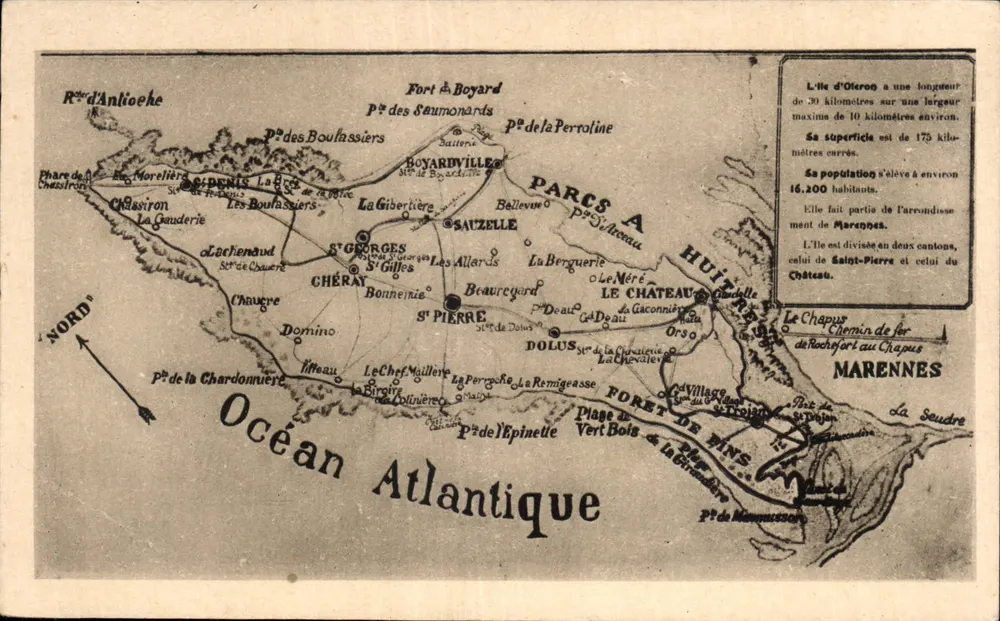
Isle of Oléron — Detailed Geographical Map — Hellocq & Combier Macon - Front
Sold
Front
Isle of Oléron — Detailed Geographical Map — Hellocq & Combier Macon - Back
Back
SoldIDS55

Isle of Oléron — Detailed Geographical Map — Hellocq & Combier Macon

Ile d'Oléron
3,00 €

This postcard has been sold

Secure payment
Free shipping from €40
14-day money-back guarantee

Description

Postcard showing a map of the Isle of Oléron with its main locations such as Saint-Pierre, Chérat, Dolus, and the Pine Forests. Printed text indicates the length, width, area, and population of the island. Reverse: publisher Hellocq & Combier Macon, space for writing, and handwritten number '14'.

Characteristics

Type
Antique postcard (CPA)
Reference
IDS55
Condition
Good condition, some light folds, corners slightly worn.
Availability
Unique piece
Condition
Guaranteed as shown in front and back scans

Information

Reference
IDS55
Back to catalogue

You may also like

Comments

No comments yet. Be the first!