Paiement 100% sécurisé
CPAPHIL
CPAPHIL
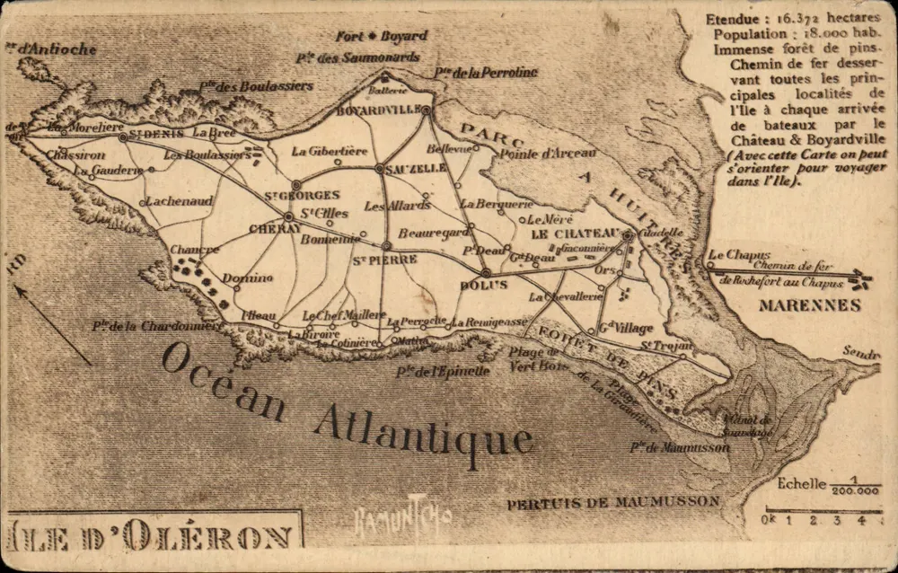
Isle of Oléron — Topographic Map — Publisher PERTUIS DE MAUMUSON - Front
Sold
Front
Isle of Oléron — Topographic Map — Publisher PERTUIS DE MAUMUSON - Back
Back
SoldFRN47

Isle of Oléron — Topographic Map — Publisher PERTUIS DE MAUMUSON

Ile d'Oléron
3,00 €

This postcard has been sold

Secure payment
Free shipping from €40
14-day money-back guarantee

Description

Detailed map of the Isle of Oléron with localities, forests, and railways, indicating a population of 18,000 inhabitants and an area of 16,372 hectares. Printed text explains the use of the map for orientation. Reverse: publisher 'Raffino artistique (L. Bergerie) - La Rochelle', postmark and circular cancellation '14' with illegible handwritten text.

Characteristics

Type
Antique postcard (CPA)
Reference
FRN47
Condition
creasing, worn corners, stains
Availability
Unique piece
Condition
Guaranteed as shown in front and back scans

Information

Reference
FRN47
Back to catalogue

You may also like

Comments

No comments yet. Be the first!